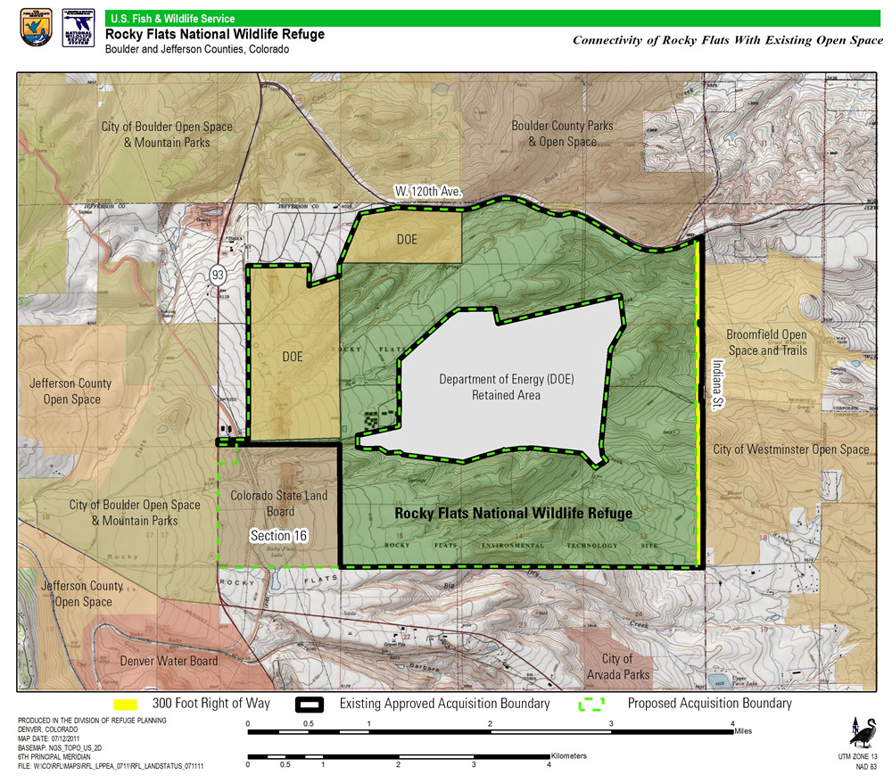
Map of Rocky Flats site showing land retained by the Department of Energy (the central more contaminated part of the site) and land now managed by U.S. Fish & Wildlife Service (FWS) as the Rocky Flats National Wildlife Refuge. The yellow strip down the eastern edge of the Refuge is the land FWS made available for construction of the Jefferson Parkway. The square plot of land at the southwest corner of the Refuge (shaded brown) is Section 16, slated to be transferred to Fish & Wildlife as part of![]()
